9.2 GPS Devices
There are two main types of GPS receivers available in the market at the moment:
Plain GPS receivers
GPS receivers with maps
A plain GPS receiver simply interprets the readings from the satellite and returns the result in latitude, longitude, and altitude. Figure 9-5 shows the PocketMap (http://www.pocketmap.com) PMG-220 CF GPS receiver. You can use the PMG-220 on your Pocket PC or your Windows XP notebook (which requires a PCMCIA sleeve for the CF card). Plain GPS receivers are useful in cases where you want to use the receiver interchangeably on your Pocket PC or Windows XP notebook computer. You also have the flexibility to use them with any other mapping software.
Figure 9-6 shows the Emtac Bluetooth GPS receiver. The nice feature of this receiver is that it does not occupy a Compact Flash slot on your Pocket PC for GPS functionality. You can connect to it wirelessly using Bluetooth and position it at a location where you can get a good signal.
Figure 9-5. The PocketMap PMG-220 Compact Flash GPS receiver with a CompactFlash to PCMCIA sleeve
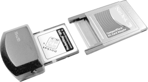
Figure 9-6. The Emtac Bluetooth GPS receiver
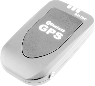
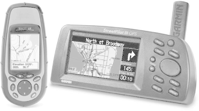
Figure 9-7 shows two standalone GPS receivers equipped with their own mapping software. The Magellan Meridian Gold and the Garmin StreetPilot III contain built-in screens to display maps. There is no need to connect the receivers to any device for them to work. Standalone GPS receivers are useful for travelers who need a lightweight GPS solution.
Figure 9-7. The Magellan Meridian Gold GPS (left) and the Garmin StreetPilot III (Magellen used by permission, Thales Navigation, Inc. 2003; Garmin courtesy of Garmin Ltd.)
9.2.1 Installing a GPS
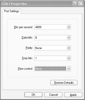
There's generally not much to installing a GPS device. To Windows XP, most GPS devices look like a COM port (also known as a serial port, best known for connecting modems to your computer). Most consumer GPS devices use serial port settings of 4800,N,8,1, which is serial port shorthand for the underwhelming speed of 4800 bps, no parity, 8 data bits, and 1 stop bit. The GPS spews information to that COM port.
If you're interested in seeing what the GPS has to say, do the following:
Launch HyperTerminal (Start
 All
Programs Accessories Communications
HyperTerminal).
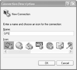
All
Programs Accessories Communications
HyperTerminal).When prompted, supply a description for the connection (such as GPS, as shown in Figure 9-8). Click OK. This brings up the Connect To dialog.
Figure 9-8. Creating a new connection with HyperTerminal
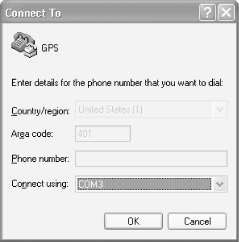
Next, select the COM port that your GPS uses (see the documentation that came with your GPS for this information), as shown in Figure 9-9. Click OK. This brings up the COM port Properties dialog.
Figure 9-9. Connecting to the GPS COM port
Set the properties to 4800, 8, None, 1, and None, as shown in Figure 9-10. Click OK.
Figure 9-10. Setting COM port properties in HyperTerminal
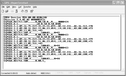
If all went well, you should start seeing all kinds of nonsense appear on your screen, as shown in Figure 9-11.
Figure 9-11. Viewing raw GPS data from the COM port