Chapter 4. Spatial Analysis
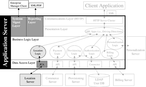
For your mobile location services infrastructure, you need two location-related functions: mobile positioning and spatial analysis. These location functions are marked in Figure 4.1 as the location server. Spatial analysis requires a digital map database and a suite of tools to perform spatial operations on the data. These spatial operations include geocoding (the process of looking up a position from an address), reverse geocoding (the process of looking up an address from a position), routing (calculating a route between two positions), map rendering (translating an area of map database into a vector or raster map), and several others. Mobile positioning is the subject of Chapter 5.
Figure 4.1. Location Server Components of a Mobile Location Service Architecture.